
CALIFORNIA
Here are the more popular and recognizable
locations, out of many in California.
Most of the LoneStar/Mongram, early Republic
and many of Duke's movies were filmed
in these locations.
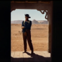
Alabama Hills
Owens Valley, Lone Pine, California
Besides Duke's early movies,scenes for
Tycoon
were filmed here
Alabama Hills are a range of hills in the Owens Valley of California,
near Lone Pine, California.
The rounded contours of the Alabamas contrast with the sharp ridges
of the Sierra Nevada to the west; however,
the Alabamas are no older than the Sierra.
Different patterns of erosion account for the difference.
Mt Whitney, the tallest mountain in the contiguous United States,
towers several thousand feet above this low range, which itself is
1,500 feet above the floor of Owens Valley.
However, Gravity surveys indicate that the Owens Valley
is filled with about 10,000 feet of sediment and that the Alabama's
are the tip of a very steep escarpment.
This feature may have been created by many earthquakes
similar to the 1872 Lone Pine earthquake which,
in a single event, caused a vertical displacement of 15-20 feet.
There are two main types of rock exposed at Alabama Hills.
One is an orange, drab weathered metamorphosed volcanic rock
that is 150-200 million years old.
The other type of rock exposed here is 90 million year old granite
which weathers to potato-shaped large boulders;
many of which stand on end due to spheroidal weathering acting
on many nearly vertical joints in the rock.
The Alabama Hills are a popular location for television and movie productions
(especially Westerns) set in an archetypical "rugged" environment.
Since the early 1920s 150 movies and about a dozen television shows
have been filmed here including Tom Mix, Hopalong Cassidy, Gene Autry,
and the Lone Ranger.
Classics such as Gunga Din, Springfield Rifle, and How the West Was Won,
as well as more recent productions such as Tremors and Joshua Tree
were filmed at sites known as Movie Flats and Movie Flat Road.
In Gladiator, actor Russell Crowe rides a horse front of the Alabamas,
Mount Whitney in the background, for a scene presumably set in Spain.
Edited by ethanedwards
Information from Wikipedia
For more photographs:-
Alabama Hills- Google Images
For more information:-
Alabama Hills-Wikipedia
_________________________________________________________________________________
Vasquez Rocks Natural Area Park
Agua Dulce, California
Scenes from early Duke films were made here.
Vasquez Rocks have been used innumerable times in motion pictures,
various television series and in moving and still photography advertisements,
and continue to be used in them today.
The triangular rock summit can be clearly seen in, for example, an Outer Limits episode
called "The Zanti Misfits", in "Arena", an original series
Star Trek episode where Captain Kirk rolls a boulder onto
an alien of reptiloid origin called a Gorn, and throughout a Bonanza episode called
"Between Heaven and Earth".
The prominent rock formation has been nicknamed "Kirk's Rock"
due to being featured in several Star Trek episodes,
each time representing a different planet.
At 905 acres, Vasquez Rocks Natural Area Park, has been a popular
California destination since its establishment in 1972.
It has been used numerously in film and television shows.
Including..The Adventures Of Rin Tin Tin.
Several scenes from the original Star Trek TV series
were filmed here, including the one where Kirk fights the Gorn (green lizard).
Other notable movies and TV were filmed here:-
Star Trek (2009)-- Featured in scenes of the Vulcun planet.
Star Trek IV: The Voyage Home (1986)
-- Featured in scenes of the Vulcun planet.
First Daughter (2004).The Scorpion King (2002)Wild Wild West (1999)
Austin Powers- International Man Of Mystery (1997)
The Flintstones (1994) -- In this movie, based on the cartoon Flintstones,
downtown Bedrock was constructed Vasquez Rocks County Park
Bill and Ted's Bogus Journey (1991)-- Bill and Ted
are betrayed by their evil robot twins at Vasquez Rocks County Park.
Bill and Ted's Excellent Adventure (1989) -- Bill and Ted come face to face
with Death in Vasquez Rocks County Park
For more photographs:-
Vasquez Rocks- Google Images
For more information:-
Vasquez_Rocks-Wikipedia
_____________________________________________________________________________
Lone Pine
Lone Pine, California
Many early and later Duke movies were filmed here, including,
I Cover the War, King Of the Pecos,
Westward Ho!, Helltown,
Blue Steel, New Frontier,
Three Faces West,Oregon Trail,
Somewhere in Sonara, 3 Godfathers,
How The West Was Won, North To Alaska
For more information on movies made here-
Movies made in Lone Pine
Lone Pine is in Inyo County, California, United States.
Lone Pine is located 16 miles (26 km) south-southeast of Independence,
at an elevation of 3727 feet (1136 m).
The town is located in the Owens Valley, near the Alabama Hills.
On March 26, 1872, the very large Lone Pine earthquake destroyed
most of the town and killed 27 of its 250 to 300 residents.
The Whitney Portal road was used in the 1941 film High Sierra with Humphrey Bogart,
which culminated with a shoot-out between Bogart's character (Roy Earle) and the police,
at the foot of Mount Whitney.
Also, there is The Forum Theater, a theater-cafe that hosts live music,
theater, and films on the weekends.
The Lone Pine Film Festival has been held every year since 1990 to celebrate the rich heritage that film makers have brought to the area over the years.
For more Information;-
Lone Pine-Wikipedia
____________________________________________________________________________
Kern River
California
In most Lone Star movies Duke and Yak,
were seen jumping in the Kern River.
Also used for the river crossing in
Stagecoach
.
The Kern River is a river in eastern California in the United States,
approximately 155 mi (249 km) long.
It drains an area of the southern Sierra Nevada mountains northeast of Bakersfield.
Fed by snowmelt near Mount Whitney, the river passes through scenic canyons
in the mountains and is a popular destination for whitewater rafting and kayaking.
It formerly emptied entirely into the Buena Vista Lake at the southern end
of the Central Valley; however, now it is diverted for irrigation,
recharging aquifers, and it still empties a portion into Lake Buena Vista
for recreational use.
In addition some of the water is diverted into the California Aqueduct.
Information from Wikipedia
For more information:-
Kern River-Wikipedia
_____________________________________________________________________________
Bronson Canyon
Griffiths Park, Los Angleles, California
Some scenes from
Hurricane Express,
Shadow Of the Eagle,
The Three Musketeers,
The Searchers
amongst others shot here
Many movies and TV shows filmed here,
for more information:-
Bronson Canyon- Wikipedia
Bronson Canyon, or Bronson Caves, is a section of Griffith Park in Los Angeles,
California that has become famous as a filming location for a very large number
of movies and TV shows, especially westerns and science fiction,
from the early days of motion pictures to the present.
Its craggy and remote-looking setting, but easily accessible location,
has made it a prime choice for filmmakers, particularly of low-budget films,
who want to place scenes in a lonely wilderness.
Location and History
Bronson Canyon is located in the southwest section of Griffith Park
and is thus easily accessible from Hollywood. From Franklin Avenue,
go north on Canyon Drive until the road ends for vehicular traffic
at the parking lot for "Camp Hollywoodland."
At the right (east) side of the road is a small concrete bridge painted red.
Cross the bridge and walk around the vehicle barrier, and follow the unpaved road,
keeping left, for the short walk into Bronson Canyon.
In 1903, the Union Rock Company founded a quarry,
originally named Brush Canyon, for excavation of crushed rock
used in the construction of city streets.
The quarry ceased operation in the late 1920s, leaving the caves behind.
The caves became known as the Bronson Caves after a nearby street,
giving the area its more popular name of Bronson Canyon.
(The same street indirectly provided the stage name for actor
Charles Bronson, who chose the name of
the Bronson Gate at Hollywood's Paramount Studios,
which in turn derived its name from Bronson Street.)
Scenes of the main cave entrance are normally filmed in a manner
that shows the entrance at an angle.
This is because the cave is actually a very short tunnel through the hill,
with the rear opening easily visible in a direct shot.
The most well known appearance of the tunnel entrance is likely
as the entrance to the Batcave in the Batman
television series of the 1960s.
For more information:
Bronson Canyon- Wikipedia
_______________________________________________________________________________________
Red Rock Canyon
California/ Nevada
Many Movies, particularly westerns were made here,
Including Duke's
Pals of The Saddle
Lawless Frontier
Red Rock Canyon National Conservation Area in Nevada
is an area managed by the Bureau of Land Management
as part of its National Landscape Conservation System,
and protected as a National Conservation Area.
It is located about 15 miles (24 km) west of Las Vegas,
and easily seen from the Las Vegas Strip.
The area is visited by over 1 million visitors each year.
The conservation area showcases a set of large red rock formations:
a set of sandstone peaks and walls called the Keystone Thrust.
The walls are up to 3,000 feet (910 m) high.
The highest point is La Madre Mountain, at 8,154 feet (2,485 m).
Geology
An outcrop of Aztec Sandstone
The Red Rock Area has a complex geological history, which over millions of years,
helped to create the dramatic landscape that characterizes the region.
The Red Rock area was located under a deep ocean basin
during the Paleozoic Era 600 million years ago.
Sediments up to 9,000 feet thick were deposited,
and eventually lithified.
This sediment eventually formed into limestone.
.
Around the Mesozoic Era 250 million years ago, the earth's crust
started to rise due to tectonic shifts, forcing the water out and leaving
behind evaporite formations of salt and gypsum.
Exposure of the former sea bed allowed some of the rocks to oxidize
(literally rust) and formed the area's characteristic red and orange rock layers.
Eventually a lush plain with streams and trees developed in the area.
Some of these trees were covered with mud from the streams
and eventually became petrified wood.
Many of these fossilized logs can still be found today at the base of the Wilson Cliffs.
By 180 million years ago, the climate continued to change and the area
became a desert featuring vast expanses of huge shifting sand dunes.
These dunes would pile up and were lithified, and are now called Aztec Sandstone.
During a mountain building period called the Laramide orogeny
around 65 million years ago, the Keystone Thrust Fault developed,
which ran through most of North America and through the
Red Rock Conservation Area.
The movement of this fault forced the older grey sedimentary rock
over the younger red rocks, forming the striking red line that
can be seen in the mountain today.
For more information:-
Red Rock Canyon-Wikipedia
_____________________________________________________________________________________
Death Valley
California/Nevada
Scenes from
3 Godfathers
filmed here
Death Valley is a desert located in Eastern California.
Situated within the Mojave Desert, it features the lowest, driest, and hottest location
in North America.
Badwater, a basin located within Death Valley,
Death Valley holds the record for the highest reliably reported temperature in the Western hemisphere, 134 °F (56.7 °C) at Furnace Creek on July 10, 1913
—just short of the world record, 136 °F (57.8 °C)
in Al 'Aziziyah, Libya, on September 13, 1922.
Located near the border of California and Nevada,
in the Great Basin, east of the Sierra Nevada mountains,
Death Valley constitutes much of Death Valley National Park
and is the principal feature of the Mojave and Colorado Deserts Biosphere Reserve.
It is located mostly in Inyo County, California.
It runs from north to south between the Amargosa Range
on the east and the Panamint Range on the west;
the Sylvania Mountains and the Owlshead Mountains form
its northern and southern boundaries, respectively.
It has an area of about 3,000 sq mi (7,800 km2).
Death Valley shares many characteristics with other places below sea level.
For more information:-
Death Valley-Wikipedia
_____________________________________________________________________________
Donner Lake
Truckee, California
The movie
Island In The Sky
was filmed here
Donner Lake is a natural alpine type body of water
which lies almost exactly "True" East/West, along the Eastern edge
of the Sierra Nevada Range (no "s" on the end, "Sierra Nevada" is already plural),
in the Tahoe National Forest.
Bounded at the West, by the infamous Donner Summit; on the North,
by Donner Ridge along which runs Inter-State 80; at the East,
by the Donner Memorial State Park; and the South, by Shallenburger Ridge
along which the main East-West Union Pacific Rail Road tracks and their
"snow sheds" are located.
The Lake itself is totally within Nevada County (Town of Truckee);
however, along the south side of the Lake, the Nevada/Placer County Lines
parallels the Lake and some subdivisions straddle this line.
For more photographs:-
Donner Lake- Google Images
For more information:-
Donner Lake- Wikipedia
_____________________________________________________________________________________
Lucerne Dry Lake
Caifornia
The famous Indian
Stagecoach
attack was made here
The chase by Indians was staged at Lucerne Dry Lake
near Victorville, California, recreated by stunt artist Yakima Canutt
from the 1937 Monogram movie Riders of the Dawn,
which was filmed at the same location.
To soften the ground for filming, 20 acres of ground had to be dug up by tractor
...
...
______________________________________________________________________________
Beales Cut
Newhall, California
Scenes from
Stagecoach
were filmed here
Stagecoach coming through
Beale's Cut
The steep pass was made easier for stagecoach traffic with a 30-foot (9.1 m)
deep cut made by Phineas Banning in 1854 as part of a road
he built to provide service to Fort Tejon.
This slot-like roadway was called Beale's Cut,and it appeared
in many silent western movies.
The location became a favorite of movie producers like John Ford and D. W. Griffith.
In Ford's 1923 film Three Jumps Ahead American film actor Tom Mix is filmed
jumping over the pass.
John Ford used the location in at least four films
over a twenty year period beginning as early as 1917.
...
From Duke's Stagecoach
In the movie this was depicted as the entrance to the above!
For more information:-
Newhall Pass (Beales Pass)-Wikipedia
_____________________________________________________________________________________
Big Bear Lake
San Bernardino, California
Scenes from
The Shepherd Of The Hills
and
North To Alaska
filmed here, and many more westerns and series
Big Bear Valley was first occupied by the Serrano Indians
approximately 3,000 years ago. In 1845, while in pursuit of Indians,
Benjamin D. Wilson discovered and named Bear Valley because
"the place was alive with bears!"
In 1860 William Holcomb was hunting bear and discovered gold instead!
What followed was Southern California's largest gold rush.
Big Bear's first dam, completed in 1884, was soon followed
by the Valley's first hotel in 1888. In 1949 the first ski resort opened
and Big Bear Lake soon became Southern California's favorite mountain getaway.
Hollywood also has a history in Big Bear.
Since the filming of "The Call of the North" in 1914,
so many motion pictures have been shot in Big Bear Valley that it has been
called "Hollywood's back lot."
"Paint Your Wagon," "The Parent Trap," "Bonanza,"
"Kissin' Cousins," "Yukon Gold" and "Dr. Dolittle" are just
a few of the memorable films that have been shot on
location in Big Bear Valley.
For more information:-
Big Bear Lake- Wikipedia
Big Bear Lake-Web-Site
_____________________________________________________________________________________
Mammoth Lakes
California
Scenes from
True Grit
shot here
The Mammoth Lakes area is in east-central California,
southeast of Yosemite National Park, and includes the Mammoth Mountain Ski Area,
widely considered one of the best ski resort areas in the United States,
and the adjacent town of Mammoth Lakes.
This general area also includes Crowley Lake, Rock Creek Canyon,
Devils Postpile National Monument, June Lake, June Mountain Ski Area,
Bodie State Historic Park, Mono Lake, and the Ansel Adams
and John Muir Wilderness Areas.
For more photographs:-
Mammoth Lakes- Google Images
For more information:-
Mammoth Lakes- Wikipedia
________________________________________________________________________________
Owens Valley
California
Owens Valley is the arid valley of the Owens River in eastern California
in the United States, to the east of the Sierra Nevada
and west of the White Mountains and Inyo Mountains
. The mountain peaks on either side (including Mount Whitney)
reach above 14,000 feet (4,300 m) in elevation,
while the floor of the Owens Valley is at 4,000 feet (1,200 m),
making the valley one of the deepest in the United States
The Sierra Nevada casts the valley in a rain shadow,
which makes Owens Valley "the Land of Little Rain."
The bed of Owens Lake, now a predominantly dry endorheic alkali flat,
sits on the southern end of the valley.
For more information:-
Owens Valley- Wikipedia
______________________________________________________________________________________
Kernville
California
Most of the Lone Star movies were filmed here.
Stagecoach
and
In Old California
scenes shot in Kernville
Kernville is in the southern Sierra Nevadas, in Kern County,
California, United States.
Kernville is located 42 miles (68 km) northeast of Bakersfield,
at an elevation of 2667 feet (813 m).
For more information:-
Kernville- Wikipedia
 and the Mrs